Mt Agung, Bali, Indonesia
Mt Agung is the largest stratovolcano on the island of Bali in Indonesia. From the popular towns of Ubud, Denpasar, Seminyak and just about anywhere else in Bali it looms high above often shrouded in clouds. It’s lower slopes are filled with green forests while the upper section rises steeply and is capped with a jagged silhouette, shaped by its latest eruption. We only planned a short visit to Bali as we were coming to the end of our 30 days in Indonesia and having heard how busy the areas near the airport are we booked a few nights in the small farming village of Sidemen. This area is located just south of the volcano in a fertile valley of farmlands. There is very little development there however the roads in and out were mostly excellent with only the concern of navigating around the many trucks making trips to and from local quarries. We hadn’t done any research for this area and just planned to relax, maybe ride around and take photos, but when I could see the volcano from the comfort of our patio I had to learn a little more about it. I read that it was a fairly large mountain at just shy of 10,000 feet and that there are two main routes to access the crater. The route closest to me was a short but challenging hike, normally done through the night to both make it for sunrise and also to avoid the heat of the day. I pulled out my GaiaGPS app and studied the route, read two or three accounts of other people’s experiences and decided I’d get up at 2am and go for it. I had read that there wasn’t a requirement to hire a guide and also that there wasn’t an entrance fee so I figured it’d be a fun activity that wouldn’t cost me anything but sore legs. Since I had no intention of climbing a mountain on this short trip to Sidemen we had checked the majority of our things into a luggage storage facility in Kuta. Thankfully I had the sense to always pack a headlamp, medical kit and rain jacket and was wearing boots since we had riden for 2 hours on a scooter to get to Sidemen. I packed a pair of socks to act as gloves if it got cold, borrowed a pair of sweat pants from my wife, again if it was cold up high and carried an extra shirt so I could change a sweaty one at the top. I took 2.5 liters of water, some peanut butter cookies and a kit-kat bar; I was ready.
Some Details for the Hike
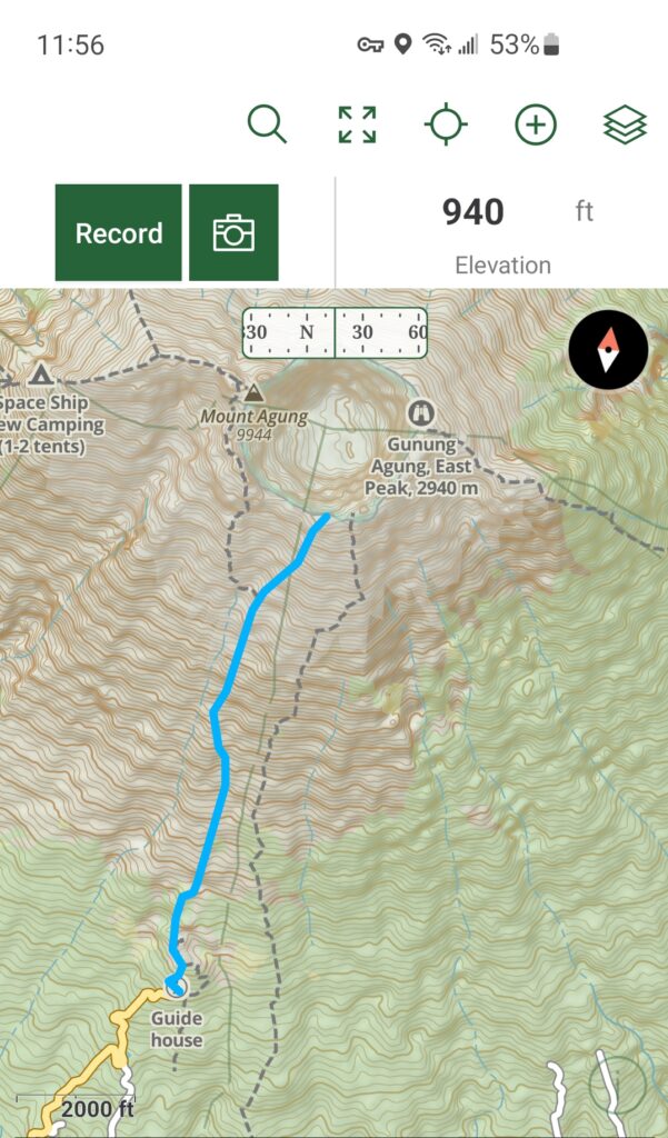
My plan was to leave at 145am and ride the hour to 1.5 hours the temple at Pura Pasar Agung Sebudi. The temple is located at approximately 5040 feet and the trail goes directly to the craters edge at 9200 feet over a distance of only 1.8 miles. This wouldn’t be a long hike but it would certainly be a steep one. Most people said the trip up would take between 2 and 3 hours with the descent being around 2 hours so I figured I’d get there right around sunrise which was at 5:50am. I figured if I got to the top sooner and it was a clear night I’d take advantage of a pretty cool star photography opportunity. I ended up getting the parking lot around 3am but due to some drama didn’t start hiking until 3:40, a story I’ll tell you about later. I reached the crater’s edge at 6:05am just in time to see the first rays of light breaking above the clouds. I reached the parking lot again around 830am and was back in Sidemen roughly an hour later.
The Climb
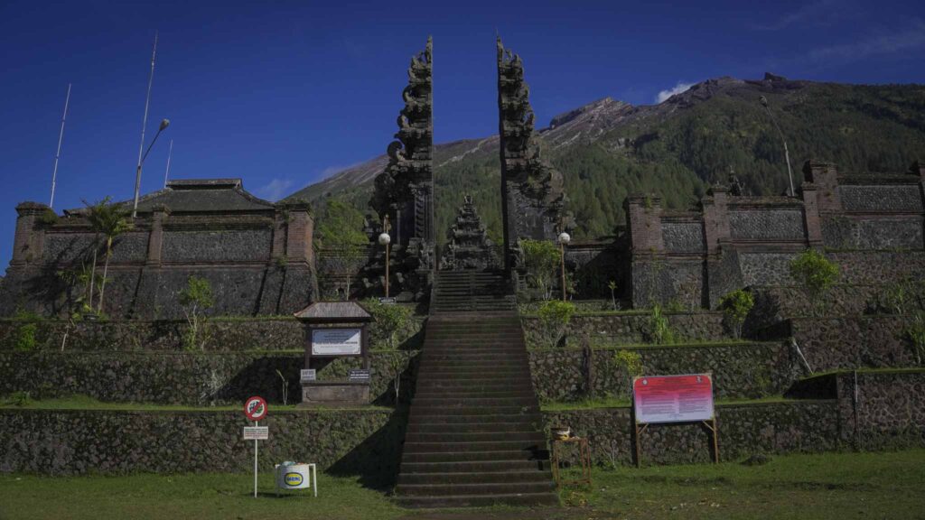
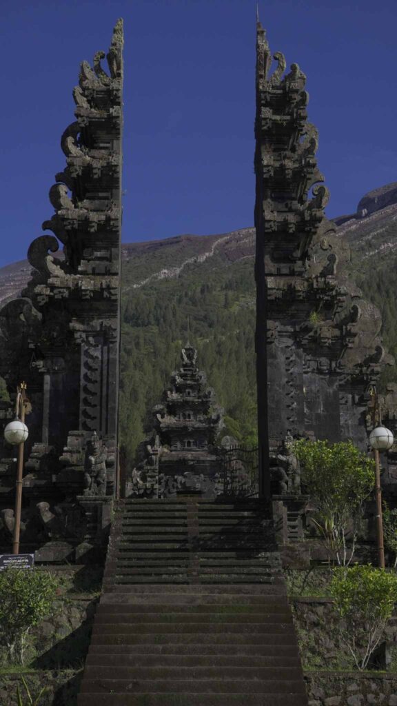
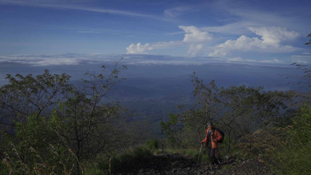
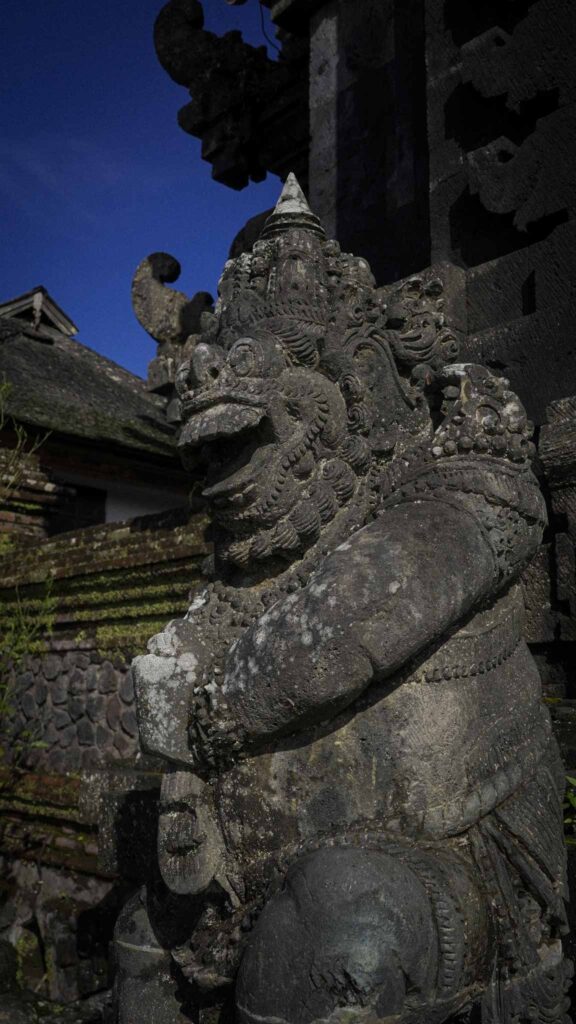
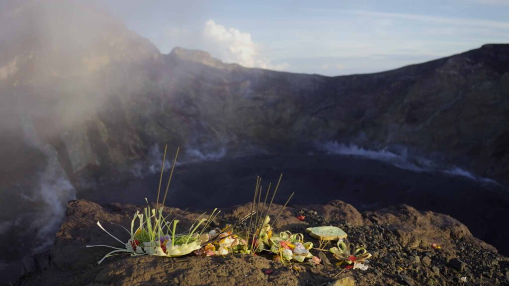
You begin the hike by climbing 6 or 7 flights of stairs to the temple plateau. As you ascend the last staircase the temple rises up above you with its carved tower gates, mystical and vicious temple guards and wide walls chiseled from black volcanic stone. This is and has been a sacred mountain for the inhabitants of the island for many years, in fact previously, you could not climb the mountain without the presence of a local priest and even to this day the climbers make offerings to their gods at the craters edge. This ancient temple at the base of the mountain added an air of mystery and reverence to the climb I was about to undertake and I took a moment to not only pray to God for safe travels as I normally do but I also spoke to Agung, letting her know I was there to enjoy her beauty and thanked her for safe passage to the top and back. The trail begins around the left side of the temple and after about 30 yards it begins its upward ascent through the dense forest. I hiked on a new moon so it was completely dark other than the spot light of my headlamp. This section of trail however is very well marked, it’s a dirt path climbing up through grasses and trees for roughly an hour before the forest starts to thin out. These lower slopes are also covered in occasional slabs of once liquid granite and early on you get your first taste of scrambling over the rocky terrain, something you’ll be getting a lot more of higher up. I hiked past a couple of campsites and a group of three people sitting by a fire waiting for the sunrise. I think I passed about 4 or 5 great camp spots, shielded from the wind and flat so if you’re interested in camping on the mountain it would certainly be an option. The furthest one was approximately an hour up before the terrain gets too steep and rocky to pitch a tent. Once you break through tree line the trail begins to steepen and there are many sections where you’ll be needing your hands to scramble up large sections of granite. It becomes a mixture of loose rock and large slabs however it’s a relatively wide path approximately 20 or 30 feet across where people have taken several routes up. At this point there didn’t appear to be any danger of large falls which was reassuring given that the wind was picking up and the mist would roll in and out. After another 40 minutes or so I encountered my first solid class 3 area. The trail seemingly ends and on either side of a granit massif are steep drop offs that have been carved by rain and wind over the years. I could see clearly, once the sun was up, that this trail was following a vein of granite whose protrusion was a result of the wearing away of adjacent material over the course of many years. I was hiking alone, which I don’t typically do, so I carefully checked the route on my map and then studied the terrain for strong evidence of trail, I could also see the faint flicker of two headlamps further up giving me additional confidence that I was going the right way. The last thing I wanted was to climb up and then realize I was in the wrong spot hoping that the only down climbing I would be doing would happen under the bright morning sun. I was right on track and could see clearly through the wearing in the rock where I needed to go, so I carefully placed my hands and feet and pressed on. This next stretch was a mixture of class 3 climbing and hiking over loose rock. The mist and clouds left the rock wet and slippery and the darkness adds to the challenge but I felt confident with every hand and foothold and it was comfortable climbing all the way. Every so often I would stop, turn off the headlamp and take in the beauty of the night sky. The clouds were clearing and the stars shone brightly through the patchwork night sky. A favorite moment was turning back and seeing the first few clouds drifting in beneath me. With the village lights spotting the hillsides, the stars filling the sky and the gentle hum of wind swirling the mountain it was a moment I’ll always remember from this hike.
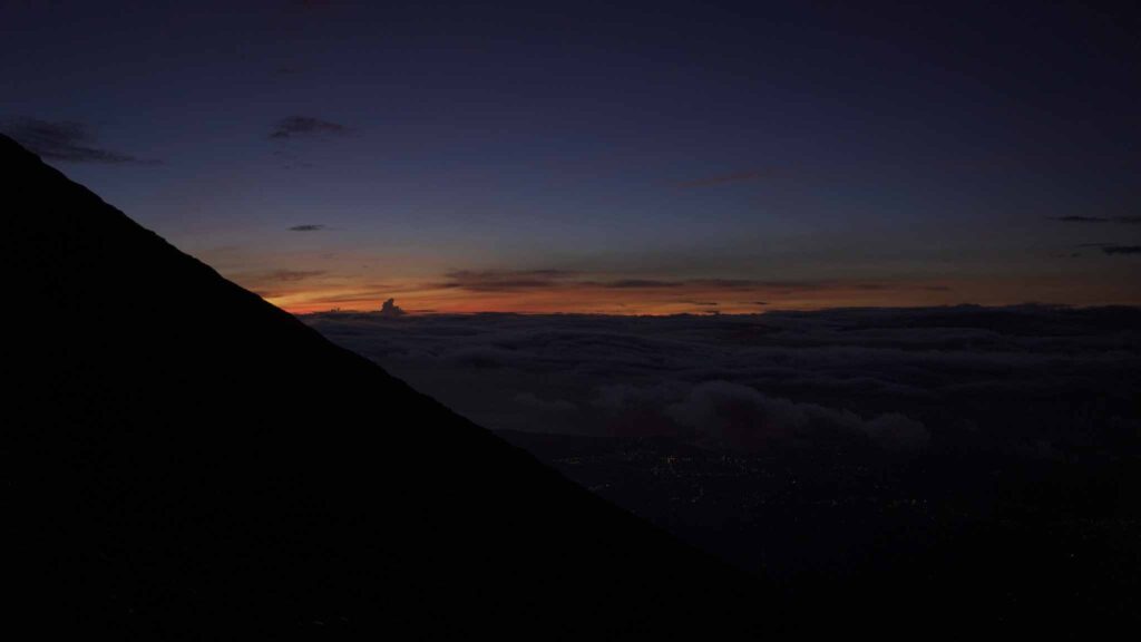
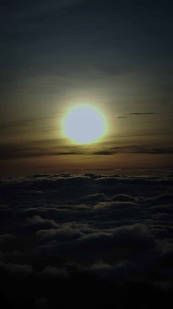
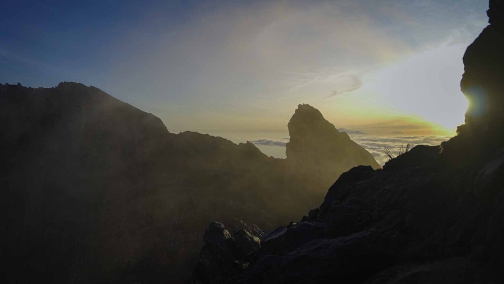
At 5:50am the first rays of lights broke the night sky, out to the east a streak of deep reds gave shape to the many clouds and I excitedly pressed on for the summit. I began to quicken my pace before checking myself, slowing down and putting safety first as this last section would prove to be the most technical. There were a few short climbs, again class 3 maybe even low-level class 4 but all with great hand and foot holds before the final walk up to the craters edge.
The Summit
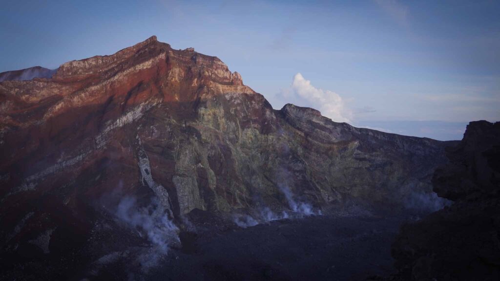
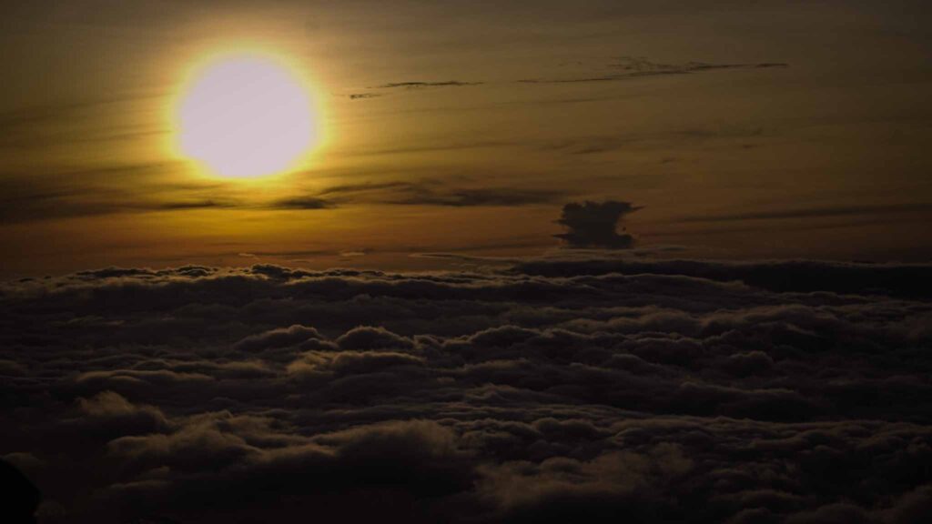
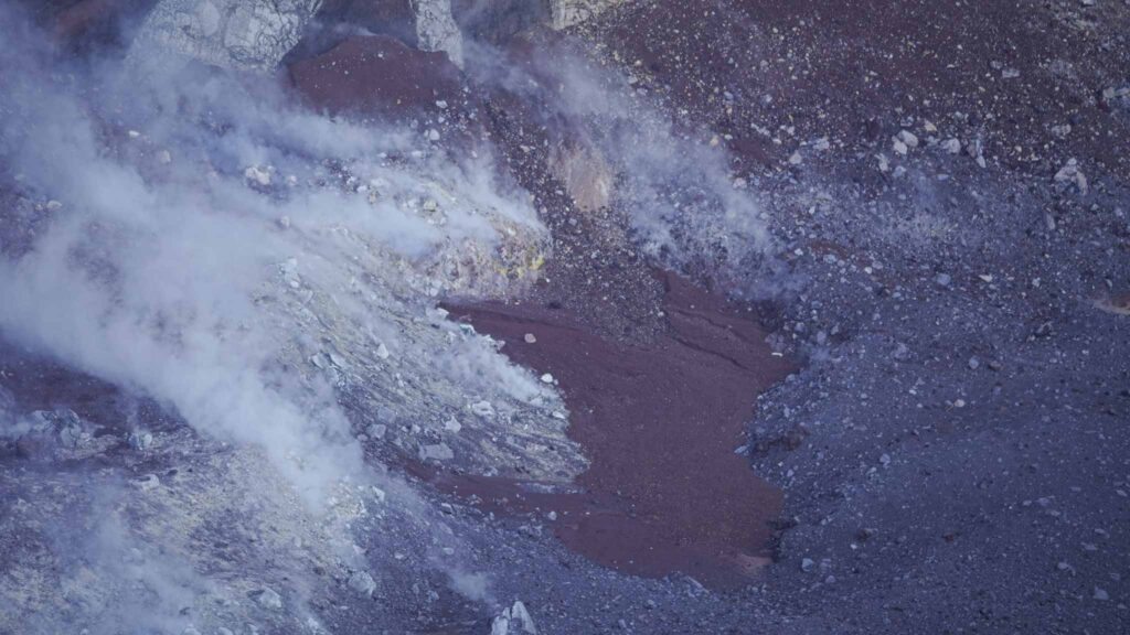
The craters edge from this point is not the highest point but it is beautiful none the less. To the north west is an amazing wall of rock with layers of color in reds and yellows. To the east is another jagged set of rocks that dance around the crater rim and are darkened by the bright sun rising above the clouds. The crater itself had a layer of loose black rock in its base and all around this circular impression were yellow fumaroles releasing sulfuric gases and steam. I don’t know if it was the distance or the strength of the fumaroles but I couldn’t hear them the way I did on the volcanoes of Sibayak and Bromo on the island of Java. These fumaroles resembled the sound of a waterfall or airplane engine and were pretty amazing to witness! Through the almost complete layer of cloud beneath me I could see the trees of the forest, wide streaks of grey granite running down the mountain and sections of the warm Indian ocean. It was a lovely and hard earned moment that I shared with about 10 other hikers and their accompanying guides. I don’t have a whole lot to say about the descent other than it is slow going. Lots of down climbing and steep slippery rock that’s easy enough if you take your time and go slow. I saw many people slip and even slipped once myself grazing my hand on a sharp rock. By the time I reached the temple again my knees were hurting and legs felt tired but I was highly satisfied 🙂
The Road from Sidemen to Pura Pasar Temple
The road from Sidement to Pasar is well paved for the most part. There is a quarry close to the base of the mountain and so there are many trucks going to and from the quarry on these small narrow roads. They make it more difficult to get around and also damage the roads but overall it’s not a bad ride on a scooter. There are little to no street lights which is true of most parts of remote Indonesia and you’ll encounter many dogs, relaxing or even sleeping in the middle of the road if you take the road in the middle of the night. Thankfully the hike begins at a famous temple so finding your way there is easy. This road passes through some beautiful farmlands and if you’re comfortable on a scooter is a really enjoyable ride. It took me about an hour to and hour and fifteen to get to the parking lot from our homestay at Maha Neka. Side note, I can highly recommend Maha Neka as a place to stay in Sidemen. It’s very comfortable and quiet, clean and they also have good food very affordably. Tourism in Sidemen is growing so by the time you get there it might cost more but for me it was $15 per night which included breakfast. At night you heard the many sounds of the frogs and insects and then you wake up to stunning views of rice fields and the summit of Mt Agung.
Ok, a quick note about the drama I mentioned earlier. I don’t like to harp on bad experiences but I’ll include this to help if you’re reading this and planning to climb Mt Agung without a guide. When I pulled up to the parking lot around 3am I was greeted by a gentleman who asked where I was going and where I was from. He asked if I was hiking alone and when I told him yes he requested that I go over to his table and register. There were two other young guys there sitting beneath an official looking banner with a registration book and table. Long story short they gave me a hard time about not hiring a guide (the two young guys were guides and were ready to go.) I informed him that I had lots of experience in the mountains, had everything I needed and a route map and thanked him for his concern for my safety however I wanted to hike alone. After a while he made me believe that he wasn’t going to allow me to hike without a guide and things got a little heated. I hadn’t read anywhere online or heard from our host back in Sidemen that there was a guide requirement so was upset and surprised to hear this. After another 10 minutes or so the guy agreed to let me access the mountain alone however he pulled out a booklet with “entrance tickets” for the cost of 100,000 rupiah. My wife and I experienced a scam in Yogyakarta (matter of fact she wrote an article on scams to look out for in Indonesia that you can read here) so at this point I questioned his authenticity and assumed he was just another guy trying to come up on some cash. I refused to pay unless he provided me with something official showing who he worked for and when he couldn’t provide anything I told him if I was doing something illegal to call the cops otherwise I’d be on my way. I began my walk up the stairs and after 5 or 10 minutes got concerned for my rented scooter that I left in the parking lot. I decided to go down and make peace, beginning with an apology for getting upset with the guys. I explained how I encountered some not-so-great people in other parts of the country and it caused me to be skeptical of them. They accepted the apology and apologized in return for being rude and confrontational. In order to make a show of good faith I asked them what their guiding fees were (between 800,000 and 1,300,000 rupiah) but they said (as I hoped and suspected) that they were not willing to guide me. They told me to go ahead and climb but they didn’t allow me to register in the book saying that my safety was my own concern now and they wouldn’t be responsible if something were to happen to me. I told them that I understood completely, thanked them again and then proceeded to have a wonderful experience climbing Mt Agung. Final note, when I got down the head guide approached me and asked that I pay the local price entrance ticket. It was 25,000 rupiah. I only had 20,000 on me for gasoline and he settled for that.
